User Log In
Members Log In Here
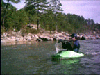
Welcome to Kayak Dog
Welcome to Kayak Dog, the website for kayakers, open boaters, and other whitewater enthusiasts.
 Recently updated in April 2016.
You don't have to become a member to enjoy Kayak Dog website and benefit from this website and all our hard work. We have the latest in river levels as we are streaming live river information from the USGS. Our server goes out and grabs this live updated information from the USGS every 15 minutes or so.
We then display the information to give you a quick visual reference whether the rivers are too low, too high, or just right for paddling. We show you trends as to whether the river is rising or falling, along with links to the USGS site, photo slideshows, information on the runs, and maps to help you get there.
WE NEED YOUR HELP
We are in the process of adding more and more rivers to our database. We need your input, your pictures, instructions to the putin and takeout, etc ...
This website is for you and your paddling friends so any information you provide will benefit the paddling community as a whole.
POST YOUR ARTICLES HERE AT KAYAK DOG
Membership is free and it's easy to join Kayak Dog! Members can write whitewater-related blogs and articles and we will submit them to Google periodically. You can include your photos in your articles for all the world to see.
CLICK HERE TO VIEW AN EXAMPLE ARTICLE I POSTED CALLED OCOEE TRIP 2015
MEMBERS CAN CREATE THEIR OWN PROFILE
Members can create their own profile as well. To view an example CLICK HERE to see my profile. You will see I have created my own personal river list on rivers I am interested in monitoring.
 KAYAK DOG MOBILE
Kayak Dog Mobile is up and on line. Optimized for your iPhone and Android. Click the KD Mobile link in the left column to enter the mobile site.
You don't have to become a member to enjoy Kayak Dog website and benefit from this website and all our hard work. We have the latest in river levels as we are streaming live river information from the USGS. Our server goes out and grabs this live updated information from the USGS every 15 minutes or so.
We then display the information to give you a quick visual reference whether the rivers are too low, too high, or just right for paddling. We show you trends as to whether the river is rising or falling, along with links to the USGS site, photo slideshows, information on the runs, and maps to help you get there.
WE NEED YOUR HELP
We are in the process of adding more and more rivers to our database. We need your input, your pictures, instructions to the putin and takeout, etc ...
This website is for you and your paddling friends so any information you provide will benefit the paddling community as a whole.
POST YOUR ARTICLES HERE AT KAYAK DOG
Membership is free and it's easy to join Kayak Dog! Members can write whitewater-related blogs and articles and we will submit them to Google periodically. You can include your photos in your articles for all the world to see.
CLICK HERE TO VIEW AN EXAMPLE ARTICLE I POSTED CALLED OCOEE TRIP 2015
MEMBERS CAN CREATE THEIR OWN PROFILE
Members can create their own profile as well. To view an example CLICK HERE to see my profile. You will see I have created my own personal river list on rivers I am interested in monitoring.
KAYAK DOG MOBILE
Kayak Dog Mobile is up and on line. Optimized for your iPhone and Android. Click the KD Mobile link in the left column to enter the mobile site.